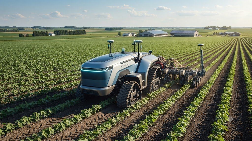
The agricultural machinery industry is undergoing an unprecedented technological transformation driven by precision guidance algorithms, machine vision sensors, high-bandwidth cloud telematics, and high-voltage battery-electric powertrains. As commercial agriculture grapples with rural labor shortages, surging fossil fuel costs, and stringent environmental sustainability benchmarks, the transition from conventional human-operated diesel tractors to autonomous and electrified platforms represents the defining technological leap of 21st-century farming. Understanding the core engineering disciplines underpinning autonomous navigation, drive-by-wire actuation, high-voltage energy storage, and automated fleet coordination is essential for forward-thinking agricultural professionals.
1. High-Precision Satellite Guidance: GNSS, RTK Correction, and Inertial Measurement Units
Autonomous field navigation begins with high-accuracy satellite positioning. Standard civilian Global Navigation Satellite System (GNSS) receivers provide positioning accuracy within 2 to 3 meters—wholly inadequate for planting crops, cultivating weeds, or traversing narrow tramlines without damaging valuable plants.
Autonomous tractors achieve repeatable sub-inch (less than 2.5 cm) pass-to-pass accuracy through Real-Time Kinematic (RTK) differential correction networks. An RTK setup pairs an onboard dual-frequency GNSS receiver with a stationary local base station or a cellular-delivered Network RTK (NTRIP) service. The base station continuously calculates carrier-phase atmospheric timing errors caused by the ionosphere and troposphere, transmitting instantaneous mathematical correction vectors to the tractor over high-frequency radio or 4G/5G cellular modems.
To compensate for dynamic vehicle pitch, roll, and yaw when traversing hillside contours and uneven field ruts, the guidance controller integrates a multi-axis Inertial Measurement Unit (IMU) featuring micro-electro-mechanical systems (MEMS) gyroscopes and accelerometers. The IMU recalculates the tractor’s true physical ground position hundreds of times per second, executing terrain compensation algorithms that steer the front axle to keep trailing implements tracked perfectly along programmed guidance swaths.
Dual GNSS antenna configurations mounted along the cab centerline determine true vehicular heading instantly upon powering up, even before the machine begins rolling, eliminating the heading drift and initialization delays that plague single-antenna guidance systems.
Modern autonomous guidance systems track multi-constellation signals simultaneously (GPS, GLONASS, Galileo, and BeiDou). Maintaining a minimum tracking lock on 14 to 18 satellites prevents satellite geometry degradation (high PDOP) near tree lines, grain silos, and steep valleys, ensuring that autonomous tractors maintain uninterrupted high-precision trajectory tracking.
2. Drive-by-Wire Actuation: Electro-Hydraulic Steering and Brake Control
Transforming mathematical guidance lines into physical tractor movement requires replacing mechanical steering columns and pedal linkages with drive-by-wire electro-hydraulic actuation systems. In an autonomous platform, electronic control units (ECUs) govern all primary vehicular commands via high-speed Controller Area Network (CAN bus) communication.
Electro-Hydraulic Steering Actuation
Autonomous steering is achieved using proportional electro-hydraulic steering orbital valves plumbed directly into the steering cylinder circuit. Guidance computers send pulsed current signals to proportional solenoid coils that meter exact volumes of pressurized hydraulic oil into the steering cylinders, achieving instantaneous steering angle adjustments with micro-degree precision without requiring a spinning steering wheel inside the cab.
Brake and Transmission Actuation
Vehicle deceleration and emergency stopping are managed by electro-hydraulic brake modulators with built-in spring-applied, hydraulically released fail-safe mechanisms. If electrical power is severed or a safety heartbeat signal times out, hydraulic pressure vents instantaneously, allowing heavy mechanical springs to clamp parking brakes and stop the machine. Continuously variable transmissions (CVTs) integrate seamlessly with drive-by-wire systems, as forward speed, reverse shuttle, and engine rpm are modulated entirely via electronic CAN bus commands from the autonomy supervisor.
| Technology Component | Primary Engineering Function | Accuracy / Precision Rating | System Redundancy Protocol |
|---|---|---|---|
| RTK GNSS + Dual Antenna | Absolute georeferenced field positioning | 1.5 – 2.5 cm pass-to-pass | Multi-constellation fallback + cellular failover |
| 6-Axis MEMS IMU | Dynamic terrain pitch, roll, and yaw compensation | 0.05-degree angular precision | Dual sensor cross-validation algorithm |
| LiDAR + Radar Sensor Arrays | 360-degree obstacle detection and classification | 10 cm – 150 m detection range | Sensor fusion with multi-camera vision networks |
| ISOBUS Class III Interface | Two-way implement-to-tractor autonomous control | Sub-millisecond CAN bus latency | Heartbeat watchdog timer with emergency shutoff |
| High-Voltage LFP Battery Pack | Tractive and auxiliary electric power delivery | 300 – 400 kWh usable capacity | Liquid cooling thermal loop with pyro-fuses |
3. Perception Networks: LiDAR, Radar, and Computer Vision Sensor Fusion
An autonomous tractor operating in open fields or high-canopy orchards must possess comprehensive spatial awareness to detect, classify, and avoid humans, livestock, wildlife, irrigation risers, fallen branches, and unmapped drainage ditches. Relying on a single sensor modality is insufficient due to variable environmental factors such as blinding dust storms, heavy fog, driving rain, and bright sunlight glare.
Autonomous architectures deploy advanced Sensor Fusion frameworks combining three complementary sensor modalities:
- Light Detection and Ranging (LiDAR): Solid-state and rotating LiDAR sensors emit hundreds of thousands of infrared laser pulses per second, constructing high-density 3D spatial point clouds around the vehicle up to 100 meters. LiDAR excels at precise distance measurement and 3D surface mapping.
- Millimeter-Wave Radar (77 GHz): Radar waves penetrate deep through airborne dust cakes, dense diesel exhaust plumes, heavy fog, and rainstorms that blind optical cameras and LiDAR. Radar detects metallic and high-density obstacles with extreme reliability.
- High-Dynamic-Range (HDR) Stereo Cameras: Multi-camera vision networks feed real-time video streams into onboard deep convolutional neural networks (CNNs) trained on millions of agricultural images. The vision model classifies detected objects—distinguishing between a harmless clump of wheat straw and a dog, child, or steel fence post.
If any sensor detects an unclassified obstacle within the machine’s safety envelope, the vehicle autonomously decelerates. If the obstacle remains in the projected path within a critical threshold distance, the tractor brings itself to a full stop, sets the parking brake, and pings the remote fleet manager’s mobile application with a real-time 360-degree video feed.
4. Powertrain Electrification: High-Voltage Batteries and Electric Drive Motors
In parallel with autonomy, tractor powertrain electrification is gaining rapid momentum, particularly in utility, orchard, vineyard, and greenhouse applications where zero emissions, reduced noise, and precise low-speed torque are paramount.
Electric tractors replace internal combustion engines and complex multi-gear transmissions with high-voltage (400V to 800V) lithium iron phosphate (LFP) or nickel manganese cobalt (NMC) battery packs powering high-efficiency permanent magnet synchronous motors (PMSMs). Permanent magnet electric motors deliver 100% of maximum rated torque at zero rpm, providing superior pull-away tractive tenacity compared to diesel engines that must rev up to peak torque curves.
Electrified powertrains eliminate clutches, torque converters, hydrostatic pumps, and complex exhaust aftertreatment systems (DPF, SCR, DEF), reducing mechanical drivetrain component count by over 60%. Furthermore, electric drive efficiency exceeds 90% from battery to axle, compared to roughly 35% to 40% thermal efficiency for high-end diesel engines, yielding dramatic reductions in operational energy costs per hour.
Regenerative braking systems recover kinetic energy during deceleration and downhill implement hauling, converting inertial momentum back into electrical energy to recharge the onboard battery pack, extending operating hours between plug-in charging cycles.
Heavy field work generates intense battery discharge rates that create substantial internal heat. Electrified farm tractors require liquid-glycol thermal management circuits with active chiller plates to maintain battery cell temperatures strictly between 20°C and 35°C. Operating batteries above 45°C under continuous heavy drawbar loads dramatically accelerates lithium cell capacity degradation.
5. ISOBUS Class III and Autonomous Implement Synergy
True agricultural autonomy requires that the implement and tractor function as a unified, coordinated cyber-physical system. Under the internationally standardized ISO 11783 (ISOBUS) Class III protocol, intelligent implements possess bidirectional control authority over the tractor.
In conventional tractors, the tractor commands the implement. In an autonomous ISOBUS Class III setup, the implement’s onboard sensors monitor operational parameters and command tractor behavior accordingly:
- Smart Balers: A high-density round baler measures windrow volume entering the pickup via ultrasonic sensors, autonomously steering the tractor left and right across the swath to ensure symmetrical bale chamber filling, while commanding the tractor to stop when the chamber is full and initiating tying cycles.
- Intelligent Seeders: A precision air seeder monitors furrow soil moisture and seed trench depth, commanding the tractor hitch to increase downforce or reduce forward ground speed when encountering heavy clay to maintain exact seed spacing.
- Autonomous Sprayers: Targeted optical weed spot-sprayers detect weeds at millisecond intervals, commanding the tractor’s ground speed to match maximum pump pulse frequencies without overdosing or underdosing active chemical ingredients.
6. Cloud Telematics, Remote Mission Planning, and Swarm Robotics
Autonomous tractors operate within comprehensive fleet management ecosystems powered by high-speed telematics. Before an autonomous machine enters a field, the agricultural manager creates an operational mission plan using desktop GIS software or mobile farm management applications.
The mission planner defines boundary polygons, unplowed headlands, waterway exclusion zones, obstacle coordinates, and optimal AB-guidance swaths. Advanced path-planning algorithms calculate the most efficient field coverage pattern, minimizing unproductive headland turning loops and reducing total machine travel distance by up to 12% compared to manual operator navigation.
Once the mission is uploaded over encrypted cellular telemetry, the tractor navigates to the field, executes the operation, and streams real-time operational telemetry—including battery state-of-charge or fuel burn, motor temperature, wheel slip, application rate, and sensor health—directly to the farm manager’s dashboard. A single qualified agronomist can supervise a swarm of three to five autonomous tractors working concurrently across different fields, fundamentally redefining labor productivity.
7. Cybersecurity and Fail-Safe Emergency Stop Protocols
Because autonomous farm tractors are heavy industrial machines operating without human in-cab intervention, cybersecurity and physical fail-safe systems are engineered with military-grade rigor. Vehicle control networks utilize authenticated, encrypted CAN-FD protocols to prevent malicious remote command injection.
Physical safety layers include redundant hardware emergency stop (E-Stop) buttons mounted on all four exterior corners of the tractor chassis, alongside high-range handheld wireless remote E-Stop fobs carried by nearby farm personnel. The wireless safety fob maintains a continuous cryptographic heartbeat signal with the tractor; if the operator steps out of range, falls, or triggers the switch, the tractor executes an immediate emergency stop sequence within 200 milliseconds, ensuring uncompromising safety across shared rural environments.
Geofencing barriers ensure that if an autonomous machine deviates by more than 30 cm outside its digital field boundary polygon, propulsion motors are de-energized, hydraulic brakes clamp down, and all implement functions are disengaged instantly.
8. The Economic and Agronomic Future of Autonomous Field Work
The convergence of autonomy, precision guidance, and powertrain electrification shifts the economic paradigm of agricultural mechanization. Instead of purchasing a single massive 600-horsepower tractor to maximize a single human operator’s productivity, commercial farming operations can deploy multiple smaller, lighter 150-horsepower autonomous electric platforms working collaboratively.
Distributing work across smaller autonomous machines drastically reduces individual axle loads, virtually eliminating deep subsoil compaction while providing operational redundancy—if one machine requires service, the remaining units continue working uninterrupted. As battery energy densities continue to climb and vision algorithms mature, autonomous and electric tractors will serve as the indispensable foundation of high-yield, sustainable, and highly automated modern agriculture.
9. Edge Computing and On-Machine Deep Learning Inference
Executing high-speed computer vision and obstacle avoidance algorithms in remote agricultural fields requires high-performance edge computing hardware mounted directly onto the tractor chassis. Because rural cellular modems frequently encounter dead zones or high latency, autonomous machines cannot rely on cloud-based server processing to execute critical obstacle stop decisions.
Autonomous tractors utilize ruggedized, liquid-cooled industrial edge computers powered by dedicated neural processing units (NPUs) and graphical processing units (GPUs) capable of processing 200 to 300 Tera-Operations per Second (TOPS). These processors run optimized neural networks that ingest simultaneous video streams from six to eight HDR cameras alongside solid-state LiDAR point clouds.
Edge inference models operate at 30 to 60 frames per second with end-to-end perception latencies below 25 milliseconds. The vision pipeline separates semantic classes in real time—distinguishing between traversable terrain (cover crops, short weeds, shallow furrows) and non-traversable boundaries (deep drainage washes, concrete irrigation headwalls, utility poles, and moving livestock). The system calculates dynamic bounding polygons around moving obstacles, predicting their trajectory across the field and preemptively decelerating or path-planning around them without requiring cloud connectivity.
10. Field Deployment Checklist for Autonomous Swarm Operations
Before dispatching autonomous tractors into commercial production fields, operators and farm managers must execute a systematic pre-operational safety and calibration protocol:
- RTK Base Station Coordinate Verification: Confirm that the local RTK base station has resolved its fixed coordinate position with minimum satellite geometry dilution (PDOP < 1.5). Verify that the cellular or radio NTRIP broadcast stream maintains steady link quality with 100% packet delivery.
- Camera and LiDAR Lens Cleaning: Wipe all perception sensor optical lenses using anti-static microfiber wipes and isopropyl cleaning solution. Dust, dried mud splatters, or chemical spray residues on camera lenses degrade neural network detection confidence scores, causing nuisance false-positive stops.
- Physical Emergency Stop Loop Verification: Walk the perimeter of the machine and physically press each of the four chassis E-stop pushbuttons. Verify that the tractor’s main electrical safety contactor trips instantly, setting mechanical fail-safe brakes. Reset the buttons and test the handheld wireless safety fob at a distance of 100 meters.
- Geofence and Exclusion Zone Audit: Review the uploaded field mission plan on the GIS terminal. Ensure all permanent field obstacles—such as guy wires, well heads, rocky knolls, and public road boundaries—are marked with generous 3-meter safety exclusion buffers.
- Implement Hydraulic Bleed and Sensor Sync: Verify that the trailing implement’s ISOBUS Class III controller communicates with zero packet drops. Bleed air from electro-hydraulic lift cylinders and perform zero-point depth calibration on level concrete before entering the furrow.


